Wednesday, December 31, 2008

Surf your Watershed


http://cfpub.epa.gov/surf/huc.cfm?huc_code=04080203


Shiawassee Watershed -- 04080203

Shiawassee

map that locates the watershed in the state
closeup map of watershed area

Watershed Profile

Watershed Name: Shiawassee
USGS Cataloging Unit: 04080203
MI 4th Congressional District
MI 5th Congressional District
MI 8th Congressional District
MI 11th Congressional District

Citizen-based Groups at work in this watershed (Provided by Adopt your Watershed)

Water quality monitoring data from this watershed (Provided by STORET)

Environmental Websites Involving this Watershed

National Watershed Network (provided by Conservation Technology Information Center) Exit EPA Disclaimer

Assessments of Watershed Health

Information provided by the United States Geological Survey (USGS) Exit EPA Disclaimer

Places Involving this Watershed

Visit the Envirofacts Warehouse to retrieve environmental information from EPA databases on Air, Community Water Sources, Water Dischargers, Toxic Releases, Hazardous Waste, and Superfund Sites Geographic searches include zip code, city, EPA Region, or county.


Sunday, November 30, 2008

Shiawassee River Trail

Great Website -- Shiawassee River Trail

http://www.oursouthernlakes.com/index.php?option=com_content&view=article&id=60&Itemid=160


Contact Us

Sara McDonnell
University of Michigan

Center for Applied Environmental Research
432 N. Saginaw St., Ste 1001
Flint, MI 48502-1950
810-767-7272 phone
810-767-7183 fax
smcdonne@umflint.edu

Wednesday, November 26, 2008

Watersheds of the Shiawassee River


http://www.springfield-twp.us/documents/ShiawasseeRiverWatershed.pdf

CLICK on picture with mouse to enlarge.
See the path from Oakland County to Saginaw Bay


Expanding the Paddling on Shiawassee River

The information was provided by Sara McDonnell,
Project Coordinator for the Center for Applied Environmental Research
at the University of Michigan - Flint.


"We want to promote the Shiawassee River as a water trail and
encourage people to kayak and canoe close to home," McDonnell said.

The first phase of the project undertaken by Headwaters Trails,
which runs by the Shiawassee River from Holly to Fenton, is already underway.
Their successes include installation of a canoe/kayak launch site,
development of a signage program, annual Holly to Fenton canoe races
and regular river cleanups and paddle trips.
Headwaters Trails is led by Sue Julian and Doug Lanyk.


"The Holly to Fenton section is being managed by Headwaters Trails.

They've already identified launches, emergency takeouts, and where signs need to be installed.

That's the first phase of the Shiawassee River trail," McDonnell said.

"There's funding secured for the signs from Holly to Fenton."


McDonnell also said because of the progress made in the first phase,

Southern Lakes Planning Initiative has taken on the next stretch of the river, from Fenton to Argentine.


"We'll be pursuing funding for signs from Fenton to Argentine this winter," she said.


McDonnell said a group, made up of representatives from Headwaters Trails,

Fenton Area Paddlers, Southern Lakes Parks and Recreation, the cities of Linden and Fenton,

Argentine Township, interested residents, teachers, individuals from the University of Michigan-Flint,

and those interested in the outdoors, met last April.


"(They) discussed the potential of extending the Shiawassee River Heritage Trial in Oakland County,

west through Genesee County by creating signage, recreation-based business, and continued river cleanups," she said.

Mayor David Lossing said people on the trail could stop at the launches and visit the different areas, grabbing a bite to eat on the way.

He said the city would do anything they could to help out this effort which would have a positive impact on the economy.

Councilor Ray Culbert said he thinks it's an excellent idea.

"(It would) really spur the growth of the economy," he said.

"It's such a wonderful asset, creating a regional trail," said Christopher Wren, city manager. "It's a phenomonal idea."

For more information regarding the river trail, visit www.oursouthernlakes.com.

Friday, November 21, 2008

Pentax Optio W60 - Waterproof digital camera

Pentax Optio W60

Rugged, Waterproof Aqua-Shooter

http://www.wired.com/reviews/product/pentax_optio_w60

Whether you're maxin' at a pool party, snorkeling a reef,
the Optio W60 has you covered.
Super-rugged and waterproof to 13 feet, this easy-to-handle,
10-megapixel aqua-shooter with 5X optical zoom makes
for a surprisingly good all-around compact.
Built for abuse, it's nearly indestructible.
Button layout easy to operate, even underwater.
Image quality is very pleasing.
Fine balance of feature set and price.

Camera Resolution: 10.0 megapixels
Optical Zoom: 5x
Digital Zoom: 5.7x
Style: Rugged, Ultracompact
Media Format: Flash, SD Card
Manufacturer: Pentax
Price: $330

Combine with sticky pod to shoot kayak movies
http://www.stickypod.com/osc/

Sunday, November 16, 2008

GPS waterproof standards

WaterProof.. Submersible.. Spray proof.. What DO these terms mean?

MIL-STD 810 Immersion Standard, Military Specification equipment
MIL-STD 810 Blowing Rain, Military Specification equipment
JIS 2-8 Japanese Water Protection Specs similar to IEC529
CFR Title 46 Part 110.15 Aircraft Civilian specifications
IEC 529 European (ECC) water protection specifications

Of these, only IEC 529 (European Community Specification) and JIS2-8 (Japanese Industry Standard) have graduated test levels. These two specifications are very similar, but IEC 529 is gaining more acceptance in Europe which is a major market for many US manufacturers and is more defined in terms of the actual test. The table below gives a summary of the requirements for IEC 529 for WATER PROTECTION PROVISIONS.

Test
Level Definition
0 Non protected, No special protection
1 Protected against falling water Equivalent to 3-5mm rainfall per minute for a duration of 10 minutes. Unit is placed in its normal operating position.
2 Protected against falling water when tilted up to 15 degrees. Same as (1) above but unit is tested in 4 fixed positions - tilted 15 degree in each direction from normal operating position.
3 Protected against spraying water, Water spraying up to 60 degrees from vertical at 10 liters/min at a gage pressure of 80-100kN/m2 for 5 min.
4 Protected against splashing water. Same as level 3 but water is sprayed at all angles.
5 Protected against water jets Water projected at all angles through a 6.3mm nozzle at a flow rate of 12.5 liters/min at a gage pressure of 30kN/m2 for 3 minutes from a distance of 3 meters.
6 Protected against heavy seas. Water projected at all angles through a 12.5mm nozzle at a flow rate of 100 liters/min at a gage pressure of 100kN/m2 for 3 minutes from a distance of 3 meters.
7 Protected against water immersion. Immersion for 30 minutes at a depth of 1 meter.
8 Protected against water submersion The equipment is suitable for continuos submersion in water under conditions which are identified by the manufacturer.


*Note: IEC 529 level 7 is designated "IPX7" and is equivalent to JIS 7. The position of "X" being left blank indicates that the unit has no special mechanical protection.
*Note: Garmin typically uses the IEC-529 spec for the design spec for water protection level for their line of GPS equipment. Marine rated GPS equipment is usually tested to IPX7.

Garmin units in current production,
rated for submersion to 1 meter for up to 30 minutes.


There has been discussion as to the degree of "waterproofness" of Garmin GPS receivers and especially the eTrex and Summit (Legend and Vista use essentially the same package).

Here is Garmin's statement on waterproofness:

Garmin reports (from a past review): "Our specifications for eTrex (and Rino) are that they are waterproof per IEC529-IPX7. IEC is a European specification published by the International Electrotechnical Commission. It is very similar to the Japanese Industry Standard JIS-8. IEC529 gives an excellent breakdown of the relative degrees of protection against water ingress. (IEC529 specification can be found HERE.) (A layman's breakdown of IEC529 can be found HERE.) By the way, our products are more waterproof than virtually everyone else's. We even test 100% of them in our factory. It costs a lot more, but we do it anyway to be sure what we ship meets IPX7. We understand and acknowledge that the marine environment can be very harsh. Even the brass contacts with nickel plating and gold over that will eventually corrode if left exposed to sea water long enough. That's the best contact material available, and we use it on all our external power contacts. All other marine electronic products in the $100-$500 class that we are aware of have this weakness. IEC529 specifies that the immersion test is to be done in fresh water, probably for this reason. The harsh environment does occasionally cause failures and we continually work on improvements to existing products while introducing new ones."

"The classification of IPX7 is for temporary (i.e. accidental) immersion in water. It is not for continuous underwater use. If the end user is looking for something that can be used underwater continuously, they need to find something rated IPX8 or JIS8. However, we are not aware of any or GPS or fish finder that is rated for IPX8 in any price category. You will see in the attached sections of IEC529, that "The manufacturer of the equipment should be consulted to determine the degrees of protection available and the parts of equipment to which the stated degree of protection applies." We recently did start to add to our packaging a note concerning the extended waterproofness of our battery compartments as the seal is rubber and over time and wear and tear, will not be able to maintain as good of a seal as when new. We have a vested interest in presenting truthful, correct information to all of our current and potential customers." (End of Garmin statement.)

Monday, November 10, 2008

Silverman Companies development

Silverman Companies new plan for developing on the North side of Grange Hall Rd.
Their revised plans include a very dense mix of residential and commercial use.
The plans DO NOT include previously negotiated plans for a connecting trail
from The Village of Holly to Seven Lakes State park.

Please call the township 248 634 9331 for more details.

Friday, November 07, 2008

Choosing a Kayak

http://www.epickayaks.com/extras/tips/equipment/choose-kayak

How to Choose a Kayak

In today's world there is a kayak designed to fit almost any recreational need. There are kayaks for white water, placid water, ocean waves, sit-in-side kayaks, sit-on-top kayaks, sea/touring kayaks, Olympic racing kayaks, fishing kayaks, marathon kayaks and ocean racing kayaks, kayaks for one person and kayaks for two. Whew! With so many options where does one begin? The best answer is to try before you buy ! Go on a guided tour from a local kayak outfitter, participate in a demo day held by kayak retailers, or visit your local kayak shop and talk about paddling.

In a perfect world all kayaks that are used on open water, ponds, lakes, estuaries, or oceans should have positive flotation in the bow and stern of the kayak. Two of the best ways to ensure positive flotation are with bulkheads, which create watertight compartments at the front and back of the kayak and will keep your kayak floating even if the cockpit is full of water, or with flotation bags that are placed and secured in the front and back of the kayak and perform as bulkheads in keeping the kayak from sinking. The need for positive flotation in a sit–on-top kayak is not essential since they are built as an airtight pontoon and will not sink if you fall off.

Proper outfitting for touring kayaks used in open water should include safety lines around the perimeter of the deck that allow you to grab and stay with the kayak in case you fall out or off. For a sit-in kayak, a crisscrossing arrangement of thick elastic deck lines behind the cockpit is essential since this is where you secure your paddle when performing a paddle float self-rescue in the event of a capsize. A good specialty outdoor paddle shop or outfitter can give instruction in these important safety aspects of kayaking.

Footbraces that are adjustable are an important feature so that you can rest your feet comfortably in the kayak against a proper support. In addition, a good seat and backrest will help you to sit upright when paddling and make you feel and look good on the water. In kayaks that are 12 feet in length or shorter, the backrest is usually very substantial. Kayaks that are longer than 12 feet usually have a lower-lumbar-support backband that allows greater freedom of movement for the paddler.

Most experts in the kayak world agree that a kayak under 12 feet in length does not go in a straight line very well when paddling in open water, so look for a kayak that is known to track well (go in a straight line). These kayaks will almost always be 12 feet long whether they are sit-in kayaks or sit-on-top kayaks. They are usually designed without rudders or skegs and are called recreational kayaks, as opposed to the longer kayaks that are called touring or sea kayaks. Whitewater kayaks are specifically designed to be paddled in rivers with fast currents and whitewater rapids. Whitewater kayaks are not used to paddle coastal areas, large lakes, lazy rivers, or oceans.

Some kayaks are equipped with foot-controlled rudders that assist you in staying on course. These are often found in touring/sea kayaks over 12 feet. A common misconception is that rudders are used for steering a kayak. While rudders can be used for casual steering to the left and right, rudders are actually designed to help keep you going straight when there are currents, wind, and wave action affecting your travel.

A popular activity with touring/sea kayaks is self-sustained travel along coastal areas, oceans, estuaries, or down lazy rivers with no whitewater. These touring/sea kayaks have hatches in the deck that allow for a week or two worth of groceries, fine libations, and all your camping gear. Another popular activity with touring/sea kayaks is fitness paddling and racing. A longer waterline length and a narrow beam (or width) generally means more speed with your double-blade paddle. Kayaking for fitness is exciting, cruising along with dolphins is fun, and you will learn to sprint if you kayak in gator territory.

Fishing kayaks are very popular and allow you to sneak up on your fish with all your favorite rods, bait, and tackle and are much less expensive than a power boat to operate. In the southeast fishing kayaks are usually sit–on-top models that allow you to get in and out easily in shallow water.

Kayaking is a wonderful lifetime sport and can be almost anything you want it to be. You can float down a river leisurely dipping your paddle in and out of the water basking in the sun. Shoot down rapids in Class I to V whitewater. Race long or short distances over the water. Let the miles glide under the hull of your touring kayak as you journey to your next destination. Paddle to your favorite fishing spot and bringing home the "fish for dinner." Some kayaks even make great photo platforms for wildlife photographers, allowing close encounters with wildlife and marine mammals. The point is, there's a great kayaking experience waiting out there for everyone.

Kayaks are made from different materials:

Polyethylene which is an almost indestructible plastic used in all types of kayaks. The major drawback with this material is the heavy weight.

Thermoplastics which are used by some manufacturers in short recreational kayaks and some touring kayaks. This material is lighter than polyethylene but not known for being very durable and is difficult or impossible to repair.

Fiberglass is used in touring/sea kayaks and is lighter than polyethylene, easily repaired, very durable, and gives better performance.

Kevlar is also used in touring/sea kayaks, however not because it is bulletproof, but because it is lighter than fiberglass and has the same durability and is easy to repair.

Carbon Fiber is the ultimate in lightness; an 18-foot-long touring kayak can weigh 36 pounds! This material gives great performance, is very tough, and is easily repaired contrary to widespread rumor that it is difficult to work with.

All kayaks are easily transported on the roof of your car, SUV, or truck. I never leave for a vacation (or a day at work) without my kayak. There are even bicycle trailers for kayaks. Kayaking is fun, healthy, and adventuresome. There's never been a better time to begin kayaking than today.

Friday, October 31, 2008

Chesaning Dam

News
$900K grant paves way for Chesaning dam removal

By MICHAEL PETERSON,
Argus-Press Staff Writer


CHESANING - The Chesaning dam is on its way out after a $900,000 grant through the Clean Michigan Initiative will help push funding for the Shiawassee River Restoration and removal of the dam.

State Senator Roger Kahn, R-District 32, has been very involved in the project and was instrumental in the push for the grant, said Bob Grnak, Kahn's media coordinator.“We think its the most wonderful thing ever,” Village Manager Marlene Schultz said. “It's not like a loan we have to pay back. We really feel fortunate and if it wasn't for Sen. Kahn we wouldn't have had this.

Total cost of the restoration - including planning, engineering and construction - is about $1.7 million. In addition to the grant, funding also will come from private citizens, businesses, the township and village.The dam has declined to the point where maintenance and repair is not a practical option.Tom Meder, coordinator for the Shiawassee River Restoration Committee, said they have been working on this project for seven years.

“The dam was deteriorating and something had to be done,” Meder said. “It has been repaired over the course of the last 30 years, but it is beyond repair now. We are going to remove it.”Engineers have developed a solution that restores fish passage, creates new river habitat, interconnects fragmented aquatic habitat and preserves the impoundment needed for the Showboat Festival, while eliminating the long-term liabilities associated with a failing dam.
Meder also believes the restoration will help to boost tourism.

“It will become a really prolific fishery now and people will be coming to use it,” Meder said. “Our campgrounds will literally be more useable because we will have fish right up near the campgrounds.”Meder explained the Shiawassee River goes right through the Chesaning campgrounds and with the dam fish cannot swim near the camping areas.

The dam was built in 1863 to create power for the grist mill and was a key element to Chesaning's success as a lumber hub in the mid-1800s.However, the dam is most notably used today for the annual Chesaning Showboat Festival, which is a major aspect of the cultural identity in the village.Meder is hopeful the project starts in the fall.

Tuesday, October 28, 2008

Pearling your kayak

His bow pearled while he was surfing and he ended up missing the eddy because he was upside down.

Pearling refers to the action of the bow, or stern, of your kayak diving under the water instead of floating on top. Pearling can happen for a number of reasons and is sometimes even done on purpose. If your kayak suddenly pearls and you were not expecting it or take actions to bring the bow or stern back to the surface you will most likely either get quickly flipped over or sent straight over onto your face.

Pearling on a wave sometimes happens when the wave is too short for your kayak. If you find yourself in this situation you will need to constantly be on an edge and continuously carving back and forth on the wave.

Pearling on a wave can also happen when a wave surges and pushes you down further in the trough of the wave. The easy fix for when this happens is to throw your kayak up on edge. With minimal surface area on the edge of your kayak compared to large surface of the deck of your kayak the buoyancy of your boat should bring the bow or stern right back up to the surface in no time. The trick is to be able to do this fast enough that you don’t get blown off the wave or react quick enough that the bow or stern does not get shoved too far down.

Pearling in flat water happens when you are too heavy for your boat or too much of your weight is forward. The easy fix for this is to shift your weight further onto the stern of the boat. This makes it harder to take strong powerful strokes and makes balancing a bit more of a challenge but it usually keeps your bow above water. However, if you are trying to do a trick such as the Plowing Ender then you will want to keep as much weight as possible on your bow.

Entering or exiting an eddy is also a common place to pearl. This is especially true at high volumes where there is a much more distinct line between downriver current and eddy current. In order to keep your bow from pearling when crossing in and out of an eddy you will want to make sure you do a peel out and lean in the direction of the current you are going into. Punching straight into or out of an eddy in a high volume river or creek typically is a recipe for a flip. However, if you are in a low volume playboat or a squirt boat then this line between eddy and current is a playground, just like a good hole is to a playboater.

Some kayaks are more susceptible to pearling while others are designed specifically not to pearl. With big volume and rounded bows and sterns creek boats are much harder to pearl then other kayaks as flipping in a creek is never a good thing. The opposite of this is a kayak with very thin but wide bow and stern. This shape is typically found on play boats where getting and staying vertical is essential.

Supposedly the term pearl came from surfing where one would throw the end of their surfboard into the on coming wave in order to make the board dive into the water.

http://www.niftytricks.com/kayak/dic/pearl.html

Wednesday, October 22, 2008

Saturday, October 11, 2008

Maps along Shiawassee River

WaterWorksPark in Holly, Michigan Map (click on yellow pin icon)


View Larger Map

3 Tubes RailRoad Bridge on Shiawassee River Map (click on yellow pin icon)


View Larger Map

Fish Lake Road take-out on Shiawassee River Map (click on yellow pin icon)


View Larger Map

Wilson Lake off the Shiawassee River Map (click on yellow pin icon)


View Larger Map

Fenton Mill Pond on the Shiawassee River Map (click on yellow pin icon)


View Larger Map

Strom Park in Fenton, Michigan Map (click on yellow pin icon)


View Larger Map

Friday, October 10, 2008

Dress to swim - everytime you paddle

Cold water removes heat from the body 25 times
as fast as cold air.

http://www.enter.net/~skimmer/openboat.pdf


COLD WATER + NO PFD = NO CHANCE !

http://www.tc.gc.ca/marinesafety/TP/Tp13822/menu.htm


Do not consider air temperature when
estimating the risk of cold water immersion!

Thursday, October 09, 2008

Map - Holly to Corunna


CLICK on photo to enlarge and zoom in

A tremendous amount of data available at :
http://gwmap.rsgis.msu.edu/viewer.htm

Map

From Shiawassee River - (Can't find it ? scroll down )


Click on the map to enlarge and zoom in

Waterworks Park in Holly
http://bbs.keyhole.com/ubb/showflat.php/Cat/0/Number/1244720/an/0/page/0

Strom Park in Fenton
http://bbs.keyhole.com/ubb/showflat.php?Cat=0&Board=EarthNature&Number=1244723&fpart=&PHPSESSID=

Wednesday, October 08, 2008

Paddling over a Dam - Just Plain Stupid

Michigan has about 2,500 dams, nearly 1,500 of them under six feet in height, according to the state Department of Environmental Quality.

Learn , study, take classes, paddle with friends, groups, etc.
Water is mischievous/ deceiving in the amount of power even light current has.

It' s a great article for discussion

http://www.mlive.com/flintjournal/index.ssf/2008/09/kayakers_death_in_shiawassee_r.html

And yeah, I did flip my boat in 32 degree water with a wetsuit on later that day below Delhi.
Fellow paddlers helped me out, no questions asked, no inquisition, just camaraderie.

We evolve and learn by taking risks while attempting to control as many external factors as possible.

Challenge people if they have safety equipment and why they aren't using it.
What's the worst that could happen...you get verbally abused for a second, so what.
I'm no paddling genius with an awesome roll and superman S on my chest, but I do care a little.

People also learn thru large paddle events -they see other boats, gear, equipment.
One thing that makes it tough is all the paddling/ rowing clubs are like islands.
Unless you visit (via e-mail) each club and invite them, it's tough to get a decent turnout.
Many don't even have webpages, they are just private lists of people who go out and paddle.
There is no one stop clearing house of paddling info in Michigan.
Canoe, kayak, sculling, whitewater, flatwater, surf, touring, racing, --thats a lot of territory !.

People are constantly buying boats and are in need of instruction, exposure to other boats,
safety protocols, in a nut shell " they don't know what they they don't know" .
How can you ask questions when your un-aware equipment like float bags exist for rec boats ?
If the guy at the shops like Dunhams/Dicks/ Cabellas etc. never told them the paddle can be offset for wind...
it all relates to a inherent problem with paddle sports in the Michigan-the land of water,water everywhere.

*When someone drowns falling off a powerboat because no vest is worn
-we the taxpayers pay for the body retrieval time, resources, etc.
No boatowner ever came up on murder one charges for negligent homicide,
had his boat impounded for the season, etc. etc.

We also pay monetarily when kayakers/canoeists do some foolish stuff.
Curious to hear comments, feedback, etc. either on the boards or via personal mail

Monday, October 06, 2008

Pics from 2008 Fall Color Tour Paddle


THANKS to all paddlers who came out
-- we had approximately 60 -70 kayakers/canoeists
and another big thank you to Heavners Livery
for additional rentals and shuttle service.

Sunny afternoon, light winds, temps in the mid 60's
all made for a great day.

Pictures of 2008 Shiawassee Fall Color Tour Paddle

http://outdoors.webshots.com/album/567721407KouRMx

Thursday, September 18, 2008

October 5th - Fall Color Paddle

Come join us for a 7 mile paddle in northern Oakland County
along the Shiawassee River for some spectacular fall colors.

Date : Oct 5th 1:00 PM
Launch : WaterWorks Park in Holly, MI
Finish : Strom Park in Fenton, MI

SHUTTLE service available

CANOE RENTAL is available thru Heavners on site that day

- WaterWorks Park - 602 South Broad St, Holly, MI 48442-1674
It's on Broad Street aka (Milford Road) in Holly

http://www.headwate rstrailsinc. org/images/ ShiawasseeRiverM ap.jpg

http://www.headwate rstrailsinc. org/images/ SE_Michigan_ Inset_Map. jpg

There will be a short presentation in WaterWorks Park, 602 Broad Street in Holly, at 1:00 pm.
about the Top of the Shiawassee Heritage Water Trail.
Participants will start from there at 1:15 pm and be off the river by 5pm.
The route is seven scenic miles from Holly to Fenton, which takes from 2 to 4 hours
depending on paddling speed.

Heavner Canoe Rental is providing canoes and kayaks for rent on site at approximately $40 apiece.
People who want to rent should make an advance reservation by calling 248-685-2379
and find out the exact price at that time.

Headwaters Trails will be providing return transportation
from Strom Park in Fenton back to WaterWorks Park.
People who bring their own craft are asked to make a
$5 contribution to that service; for others, transport is included in the price of renting.

The river is high at this time and clear of obstacles, so passage over beaver dams
and around tight corners should be fairly easy.

The event will take place even if the day is cloudy,
so participants should dress for the weather.

In the event of thunderstorms, we will, of course, cancel as the
final mile across the open Fenton Millpond could be dangerous.
However, the crisp air and the sight of fall foliage along the way make
this one last treat before the winter season sets in.

Come join us for "Canoeing in Color."


Headwaters Trails, Inc.
Sue Julian, President: 248-634-3513 : sjulian@provide. net
Doug Lanyk, Vice-President: 248-634-4551 : dslanyk@comcast. net

Background info
http://shiawassee- river.blogspot. com/

We're pushing for a Heritage Water Trail from Holly all the way to Bay City
Right now it's navigable from Holly thru Fenton, on to Linden and Argentine.

Thursday, September 11, 2008

Shiawassee River Task Force

Planning Activities

The Shiawassee River Task Force had its beginnings in 2000 with a Great Lakes Matching Grant from the Land Trust Alliance to Oakland Land Conservancy and North Oakland Headwaters Land Conservancy. The Task Force coordinates four conservancies in land protection and stewardship activities throughout the Shiawassee River watershed in Oakland County. Key partners include Oakland County Planning & Economic Development Services, Michigan Chapter of The Nature Conservancy, Michigan Nature Association, North Oakland Headwaters Land Conservancy, the Townships of Holly, Rose, and Springfield, and the Village of Holly. The local communities in the area have adopted innovative approaches to planning and zoning, such as cluster developments and resource overlay zones, to protect these sensitive features. Current activities include land and water trail development and continued protection and stewardship activities.

For More information please contact:

Shiawassee River Task Force
P.O. Box 51
Holly, MI 48442
Contact: Sue Julian, Coordinator
248-634-3513
sjulian@provide.net

Sunday, September 07, 2008

Tuesday, August 26, 2008

Kayak Raffle - Walden Adirondack

HeadWaterTrails Inc. in Holly,MI is raising money thru donations, grants and raffle tickets for a
Shiawassee River mid-point landing located on Fish Lake Rd. in Holly.
The group will be selling raffle tickets for a Walden Adirondack kayak and accessories.
Actual drawing will be held December 12, 2008.

HeadWatersTrails Inc. on the internet
http://www.headwaterstrailsinc.org/about_us.htm

-Sue Julian, President:
248-634-3513
sjulian@provide.net

-Doug Lanyk, Vice-President:
248-634-4551
dslanyk@comcast.net

WALDEN ADIRONDACK


The Walden Adirondack Kayak Is A Favorite For General Recreation.
It's Large Cockpit Allows Easy Access And Plenty Of Room.
The Adirondack Also Has An Optional Retractable Rudder

Map - Shiawassee River - Fenton to Linden

Map - Shiawassee River - Fenton to Linden


http://www.umflint.edu/caer/images/fentonTOlinden.pdf

Put-In at Bush Park in Fenton

For those looking to launch their kayaks or canoes onto the Shiawassee River in Fenton,MI
--Bush Park offers a nice venue that is always open with no fees.
Bush Park launch site is best accessed off N. Leroy Street & 5th Street


View Larger Map


Monday, August 25, 2008

Genesee Regional Trail Council

It would be really neat if the Genesee Regional Trail Council made trails happen along the Shiawassee River and the local lakes.
HeadWatersTrails Inc. in Holly works at getting trails connected
beyween adjacent communities for all to enjoy the great outdoors.

http://www.co.genesee.mi.us/gcmpc-plan/Files/Maps/Trails%20Maps%20Updated/Fenton.pdf

http://www.co.genesee.mi.us/gcmpc-plan/Trails.htm

http://www.co.genesee.mi.us/gcmpc-plan/Files/Docs/Trails/Approval%20Trail%20Plan%

U of M - The Southern Lakes Planning Initiative

Sara McDonnell
University of Michigan
Center for Applied Environmental Research
432 N. Saginaw St., Ste 1001
Flint, MI 48502-1950
810-767-7272 phone
810-767-7183 fax
smcdonne@umflint.edu

Sara McDonnell thru Southern Lakes Planning Initiative has worked with HeadWatersTrails Inc. in Holly, Mi and Fenton, MI
to conduct paddling inventories, identification of assets and developing strategies for branding the Water Heritage Trail .


http://www.oursouthernlakes.com/index.php?option=com_content&view=article&id=60&Itemid=72

Friday, August 15, 2008

Update - Shiawassee River Conditions

A review by Doug Lanyk from HeadWatersTrails August 14th, 2008

My how things change.
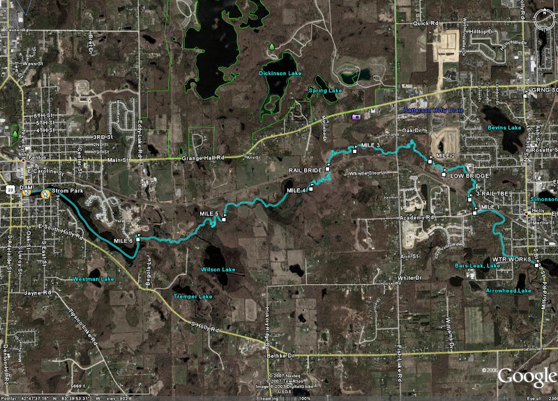
Jimmy and I Took a trip yesterday evening from
Holly's Waterworks Park to Bush Park in Fenton.
My expectations were slightly low water and an easy paddle.
So much for my powers of precognition.
The water level at waterworks park was about 3 inches higher
than I would have thought. The recent rainfall that missed
my house must have hit somewhere else in the headwaters region.

It was a good start to the journey. The river was quiet
and the wildlife was repeatedly surprised by us quietly
gliding down the river. Numerous deer, fish, turtles,
and heron were motivated to seek further cover upon
being observed at close quarters.
There is a tree partially blocking the river just after
the 3 tubes. You can still paddle around on the the shallow side.
It's small and will be easily removed, but beware if you try it,
it's covered in poison ivy. The quiet paddle was just about
perfect until another downed tree just before Fish Lake Rd.
Last week Jimmy had to portage the tree. Last night we had enough
water to bump over it. Once again it was smooth sailing.

The next item of note was the water level in Haddon pond.
It was noticeably lower. The beaver created marsh following the
pond had lot's of fresh bank showing and a bit of challenging
paddling to go around trees we are accustomed to going over.
The reason for the low water level was soon apparent.
The big beaver dam is gone! I don't know if it had help
but the center of the old dam is now completely washed out.
No drop whatsoever. This has aesthetic ramifications.
The old dump that comes up to the river at that point
is now showing a whole lot of garbage.

Some new work near Scarbury's Ford was noticed too.
The ford itself had low water and we had to bump our way across.
The last beaver dam before the Fenton Millpond has been beefed up.
It's now bigger and badder than ever before.
It's about a one foot drop that we skated over.
The millpond itself was a pungent mess. It is severely grown over.
It was a bit of work to get the boats across.
After dumping our first load of picked up garbage off at
Strom park we were rewarded for our work by finding a
blue grass band playing at the bandstand in Downtown Dibbleville.

As we portaged the dam, lot's of curious people questioned us
about paddling on the river. It was a good opportunity for
educating more people about our efforts. Below the dam
we launched Jimmy in his canoe just before I did a seal launch
off of the rocks. It was fun when the the crowd listening to the
band brokeout in applause and cheers in the middle of a song.

From the Dam to Bush Park was a bigger challenge than the millpond.
The water had disapeared. It was very shallow for most of the rest
of the trip. Where we did the cleanup a couple of weeks ago it was
hard to tell we had been there.
The trees that were totally submerged when we cut those above are
now completely above the water. More garbage has been exposed too.
By this time it was getting dark and we were glad that my truck was
right there. A longer trip would have been less than fun.

Get outside.
Doug.

Friday, August 01, 2008

Shiawassee River Trail connects to Lake Ponemah


***__Click on image for a full size view___***

--Look carefully to follow the Shiawassee River (blue line)as it connects to Lake Ponemah on thru Bush Park in downtown Fenton, along the old mill pond to Wilson Lake (follow Grand Trunk Western Railroad tracks) over near Holly and from the WaterWorks Park on Broad Street in Holly.

Thursday, July 31, 2008

Shiawassee River Trail gets longer

A big thank you goes out to all the volunteers who helped cleaning out the river in Fenton. Debbie (our organizer), Tom, Dave, Willi, Sharon, Pete, Jimmy, Sara, Andy, Maggie (our car spotter) and I got wet and had fun. At 6:00 we started in Bush park in Fenton and went up stream toSilver Lake Road. There were 3 major log jams and several smaller blockages to remove as well as a couple of bags of garbage, plus a chair, a bike, a municipal garbage can... Working near the park had it's advantages. We just had to bag the garbage and put it up on the bank in the park. The city of Fenton will pick the garbage up. By 8:30 we had made it back to our starting point. Several people had to head home at this point. Five of us continued on down stream to our trucks about half way to us 23. This portion had a cleanup a month ago. We still found a bag of garbage and a few trees to trim back. The river is surprisingly scenic for being in the city. There are only a few lawns in view considering we are in the heart of the city. Aside from the seasonably low water this will be a fun segment. There is a fairly brisk current moving you along. It was 9:30 by then and time to call it a day. Now the bad news. There is more work to be done. As near as I can figure we have 8 more blockages to clear on the way to Lake Ponemah. One of which is fairly substantial. The date picked to finish this off is Sunday August 3rd. More details to follow. Once again thanks for your support. We are within striking distance of having a 20 mile stretch of scenic river in paddling shape.

Doug Lanyk - HeadWatersTrails__Vice-President


Wednesday, July 02, 2008

Outdoor Life Magazine

Hi, Willi,

We’re writing to let you know that your project has been chosen as one of this year’s Outdoor Life Save-a-Stream projects. We are excited to help you get your work started and to hear of your progress over the summer.A kit will be going out to you this week, containing stream restoration materials to help you in your efforts. It includes contact information as well, should you need to talk to someone about the project. You can also e-mail me if you have any questions.

Thanks for all the work you do to keep our streams and rivers clean! We look forward to seeing photos or video of your results and to sharing reports of your progress with our readers.

Sincerely,
Camille Rankin
Managing Editor
Outdoor Life

Monday, June 09, 2008

A story of boat names

Interesting story taken from a paddling magazine :

Nowhere did anyone say that a sea kayak is a CANOE with certain attributes. Nobody I know (with the possible exception of John Wilde) calls their sea kayak a canoe. If this is the case, why are all the bodies which oversee sea kayaking (Australian Canoe Federation, NSW Canoeing Board of Canoe Education, etc.) listed as CANOEING organisations?

Blame it on the POM’s (for our overseas web site visitors POM is an Australian name for English persons - not complimentary. Perhaps derived from early convict "Prisoner of Mother England”, thus POME, or more frequently, POMMIE **stard. May also be a corruption of "Pong", meaning to smell badly. Pom’s bathe only infrequently and NEVER wash their socks).

The bloody Pom’s, with typical Imperial hubris, simply called all indigenous paddle craft ‘canoes’ (which word comes from the Carib Indian ‘kanu’, later Spanish ‘canoe’). This linguistic arrogance also resulted in that transcontinental traveller, the short-tailed shearwater, being called a ‘Mutton Bird’ and the highly prized abalone a ‘Mutton Fish’. Perhaps all the bully beef had affected their taste buds.

Of course, for many years, explorers had been using native American canoes for their expeditions. These light, swift craft were ideal for the vast system of lakes, rivers and streams the New World offered. The Iroquois and Algonquins could quickly outdistance any European boats and were in demand for exploration. But when the white men and their Native canoeists met up with the Inuit in Northern Canada, the kayaks blew their doors off.

The Inuit could paddle away from the Algonquins even more easily than the Algonquins could swamp the Europeans. Instead of finding out the true name of these racy craft, the unimaginative and linguistically challenged British simply called them ‘canoes’. Now we are left with the problem of sorting out all this intellectual laziness. The Poms attempted to solve the dilemma by calling canoes ‘Canadian Canoes’. This may work in the UK and Australia, but brings blank stares in North America where a canoe is a canoe and a kayak is a kayak and all the canoes in Canada are Canadian.

The origin of the name ‘kayak’ is a bit obscure itself. Zimmerly used the title ‘Qajaq’ for his excellent book on the Kayaks of Siberia and Alaska. Qajaq is simply Inuit spelling for ‘kayak’. Of course the Inuit had no written language, and this spelling was invented by missionaries. Zimmerly doesn't mention where the word came from in his book. It could well have been a local name which was picked up by the white men and spread by them as a generic term as a matter of linguistic convenience.

If I understood Larry Gray correctly as he spoke about his Greenland experiences, sometimes each specific type and even individual kayak had a certain Inuit name. Chris Cunningham wrote “Qajaq shows up in HC Petersen’s ‘Skinboats of Greenland’ glossary as the Greenlandic term for a kayak.”

The Aleutian ‘Baidarka’ offers no clues. Baidarka simply means ‘small boat’ in Russian, the language of the first explorers of that vast chain of islands.

Monday, May 26, 2008

Riparian Corridor Planning


(click on the Shiawassee River Map to enlarge it full size)
Oakland County Planning and Economic Development

The unique opportunity within the river corridor is the ability to protect
significant natural areas before they are destroyed.

The relatively rural character also affords other opportunities
- such as trail development and natural areas management.

http://www.oakgov.com/peds/program_service/es_prgm/rip_green/rg_shiawassee.html

Key partners include Oakland County Planning & Economic Development Services,Michigan Chapter of The Nature Conservancy, Michigan Nature Association,North Oakland Headwaters Land Conservancy, the Townships of Holly, Rose, and Springfield, and the Village of Holly

Saturday, May 24, 2008

River races take place in Holly


By: Anna Troppens, Associate Editor
©Tri-County Times 05/24/2008

Holly - Douglas Lanyk, of Rose Township, doesn't usually get to participate in Headwaters Trails' Holly to Fenton Races and Pleasure Paddle. As a member of the organization, he's helping run the event. This year, Lanyk, who is vice president, was able to take his canoe along the route afterward, cleaning up any trash left behind (there was none) and checking for anyone who hadn't completed the course.

Lanyk's 90-year-old father, Louis Lanyk, (picture) was along for the ride in the same canoe. Louis gave the large canoe to Douglas 25 years ago. Louis taught Douglas how to canoe 41 years ago, Douglas said. His father hadn't been in the canoe for 25 years. "It was nice to get him paddling."

Thirty-eight total canoes and kayaks launched, carrying 47 paddlers. These included the afternoon Pleasure Paddlers. "It was a wonderful day," Douglas said. "You can't beat a day on the water." Participants enjoyed the diverse landscapes along the route and appreciated the trail work and race day support of the volunteers of Headwaters Trails. They spotted animals such as sandhill cranes, blue herons, turtles and muskrat along the way. "Normally, I see lots of critters out on the river," Lanyk said.

Wind was a big factor on the Fenton Millpond, the last mile and a quarter of the course. "It was warmer this year, but much windier," President Sue Julian said.Paddlers struggled against the 30 mph gusts to finish the course. "Nobody really appreciated the big breeze at the end," Lanyk said. Volunteers towed a couple of boats containing children, which were being blown around. But participants were happy. "Everybody I talked to had a big time, and big smiles," he said. "Even the people in the two canoes that tipped over were smiling at the end."

Monday, May 19, 2008

Race Results - May 18th, 2008 Shiawassee River

Race Results - scroll down for pics and videos

Experienced Class: 1st Place: Martin and Hunter Spees with a time of 1 hour, 28 min, 40 sec; 2nd Place: Lennie Brousseau and Collette Simerson with a time of 1 hour, 31 min and 25 sec; 3rd Place: John and Ben Cox with a time of 1 hour, 42 min and 25 secs.

Novice/Youth Class: 1st Place: Matthew Hill and Adam Schneider with a time of 1 hour, 51 min and 40 sec; 2nd Place: Matt Weber and Brandi Whiteman with a time of 1 hour, 55 min and 14 sec; 3rd Place: Louis and Bonnie Nickels with a time of 2hours, 18 min, 05 secs.

Solo Class (Kayak or Canoe): 1st Place: Ken Foss with a time of 1 hour, 29 min, 20 sec; 2nd Place: Justin Davis with a time of 1 hour, 31 min, 35 sec; 3rd Place: Mark Irish with a time of 1 hour, 32 min, 35 sec.

Thirty-eight total craft launched carrying 47 paddlers, including the afternoon Pleasure Paddlers. Everyone enjoyed the diverse landscapes along the route and appreciated the trail work and race day support of the volunteers of Headwaters Trails. The one wish was for less wind which was a big factor on the Fenton Millpond, the last mile and a quarter of the course. We hope 2009 weather will be more cooperative!

Webcam VIDEO & Photos - Shiawassee River Paddle Event 2008

Video of the racers on the Shiawassee River Water Heritage Trail

http://home.comcast.net/~hollywastewater/CANOEvideo.htm

Keep in mind these pictures were taken from several hundreds of yards away - very windy conditions made it difficult to shoot clear pictures.
-- Right click to save pictures.

Webcam photos & video taken alongside the river - THANKS guys !!!!

http://home.comcast.net/~hollywastewater/CANNOE%20RACE.htm

Shiawassee River Paddle Event 2008

With dark clouds and rain in the late morning along with wind gusts topping out at 27 mph at 2:00 pm & a high temperature of only 55 degrees approximately 50 brave souls still showed up to paddle the Shiawassee River on May 18th, 2008.

Many many thanks to all the volunteers who braved the weather to put on this event hosted by HeadWatersTrails Inc. in Holly. Oakland County Sheriff Marine Patrol even stopped by with their boat to take a look around and assist local Police with traffic.

Heavners Canoe Rental once again made canoes available to all people that wanted to paddle and provided a much needed shuttle. .
West Marine donated the use of a very large inflateable race buoy.
REI had granted funds to build a bridge linking the 2 sections of WaterWorks together.
To all the other sponsors I may have missed…a sincere Thank You !

Videos and Pictures of the race are available by
scrolling down the webpage

2008 Shiawassee River Paddle Event Video & Pictures

2008 Shiawassee River Paddle Event


2008 Shiawassee River Paddle Event


Shiawassee River Paddle Event Video 3

Shiawassee River Paddle Event Video 2

Shiawassee River Paddle Event Video 1

Wednesday, May 14, 2008

Finding items on the blog

If by chance you couldn't find what you are looking for
-scroll down to the very bottom-- links are on the far right.

I designed the page using an LCD Widescreen Monitor
(16:10 widescreen aspect ratio) and the far right hand side
links may be forced to the bottom of the blog on a standard monitor.

If something doesn't appear immediately - scroll up and down a bit - it's there !

Tuesday, May 06, 2008

Maps WaterWorks Park & Strom Park

Map for Shiawassee River,
Map for Water Works Park in Holly
Map for Strom Park in Fenton

http://shiawassee-river.blogspot.com/2007/10/map-for-shiawassee-river.html#links

Sunday, April 13, 2008

Shiawassee River Map

Map of the rivers and lakes near Holly, Michigan


http://www.oakgov.com/peds/assets/docs/es_docs/rg_shiawassee_map.pdf

The Shiawassee River flows from Holly towards Fenton

Saturday, March 29, 2008

Shiawassee River Paddle Event and Race

Shiawassee River Paddle Event and Race
Sunday, May 18, 2008


Start : WaterWorks Park in Holly, Michigan

End : Strom Park in Fenton, Michigan

Distance : 7 scenic miles of numerous twists and turns


Schedule :

10:00 am : On-site registration begins WaterWorks Building, Broad Street

11:30 am : Introductory Ceremony North side WaterWorks Park

11:45 am : Experienced Canoeists Start at Millpond, Broad Street

12:15 pm : Novice/Youth Canoeists Start at Millpond, Broad Street

12:45 pm : Kayak/ Single person canoeists Start on Shiawassee River, Broad Street

1:15 pm : Leisure/fun paddle Start on Shiawassee River, Broad Street

6:00 pm : Final river sweep completed


On-site availability of snacks and water.

Shuttle transport from 1pm – 6 pm for continuous transport of boats/ people

Trophies for First and Second Place in all three races.

For more info and photos, visit our website
http://www.headwaterstrailsinc.org/

Registration Forms :
http://www.headwaterstrailsinc.org/RiverRaceregistrationform2008.pdf

Questions ? Call Sue Julian, 248-634-3513.

Rain or Shine !

Sunday, March 16, 2008

RACE Shiawassee River May 18 2008

May 18, 2008 Shiawassee River Paddle Event

If don't own a boat - Heavners Canoe rental will be on site !!

Compete against other adventure racers in a 7 mile Paddle Race,
OR do the leisure paddle with friends and family after racers depart.

Put-In = WaterWorks Park on Broad Street (Milford Rd) in Holly,MI
Take-Out = Strom Park in Fenton,MI

A river in Oakland County many have yet to paddle !

http://www.headwaterstrailsinc.org/images/ShiawasseeRiverMap.jpg

http://www.headwaterstrailsinc.org/images/SE_Michigan_Inset_Map.jpg

Highly Detailed - Mileage markers
http://preview.tinyurl.com/22fg6e

Ice Paddle on Shiawassee River

Hi All;

It was a great day for a paddle. Good weather and good participants. 7
of us set out at 11:40 from Waterworks Park in Holly. Brian, Tom, Mary,
Pete, Scott, Rodney and myself started on the grand adventure. The
River was high, about an inch from flood stage. Lots of waterfowl,
turkeys and herons were on the river. The poor ducks were starting to
nest and not appreciating the traffic 2 feet away. We found several log
jams, and 2 20"diameter trees in last falls tornado zone in the river.
With some good humor and a few groans we managed to portage or hop all
the obstacle. The 3 railroad tubes posed a challenge for 2 of our crew,
or maybe it was they were too hot and wanted a dip to cool off.
Watching kayakers swimming was interesting and unexpected. Aside from a
challenging stretch the river was clear with just a little ice around
the edges. The Fenton millpond was something else. The first half mile
was straight into a brisk wind. The second half Mile was still into the
wind but we were pulling our boats and walking on less than perfect
ice. Just the kind of event to make a good story about the day. To top
it off the first snow flakes were coming down just as we finished.

We'll be having a cleanup in April to get ready for the fun paddle and
race in May.

Good paddling;
Doug.

Tuesday, March 11, 2008

Ice Breaker Paddle

Hi All;

I'd like to organize a paddle down the Shiawassee From Holly to Fenton,
on Sunday the 16th of March. The river will be very high and the water
quite brisk. The end of the trip may have some Ice on the Fenton Mill
Pond, so we may have a short walk across the ice. I'd like to launch at
11:00 AM from Waterworks Park in Holly. It will be a 3 to 3 1/2 hour
paddle. Just in case I'm bringing a chain saw and other emergency gear.

Headwaters Trails Inc. is putting a down payment on the future public
access point in Oakland County. We have 7 months to raise the next 10K
to buy the property. So I will be doing a sales pitch as we pass the
property. I'll even throw in some goodies donated by concerned
business's.

Give me a shout.
Douglas Lanyk
248-634-4551
dslanyk@earthlink. net


__._,_.___

Sunday, March 02, 2008

Pictures from 2008 Quiet Water Symposium

2008 Quiet Water Symposium

For those folks who couldn't attend this year :
Pictures of what you missed are available
by clicking on the link below

http://community.webshots.com/album/562666275yLBLRo

Attendance was up 25 % from last year
as paddling sports continue to grow.

Click on the picture to view ALL the photos :

Image hosted by Webshots.com
by willi_h2o

Saturday, February 23, 2008

Corporate Racers on Shiawassee River

Good Day;

I'm Douglas Lanyk, Vice President of Headwaters Trails Inc.
I have a challenge for all of you.
Which organization has the best paddling team?
On May 18th, 2008 we are having our 4th annual Race
and fun paddle down the Shiawassee River from Holly to Fenton Michigan.

My newest idea is to add a corporate challenge into the racing classifications.
Is anyone up to proving that they have the best equipment
and staff by getting on the water?

We will have a lot of paddlers on site for the event.
You can show your best boats and gear to a targeted audience.

http://www.headwaterstrailsinc.org/


Please provide some feedback.
Race plans are under way.

Sincerely
Douglas Lanyk
dslanyk @ earthlink . net

Monday, February 18, 2008

Launch Site

Launch Site for Shiawassee River Race

- WaterWorks Park - 602 South Broad St, Holly, MI 48442-1674
It's on Broad Street aka (Milford Road) in Holly

http://www.headwaterstrailsinc.org/images/ShiawasseeRiverMap.jpg

http://www.headwaterstrailsinc.org/images/SE_Michigan_Inset_Map.jpg

Map of Shiawassee River

New link Shiawassee River Heritage Water Trail http://www.umflint.edu/resources/pdf/outreach/shiawasse-river-trail-map.pdf Click on map for larger, more detailed, view of the area


Saturday, February 16, 2008

Quiet Water Symposium

Doug Lanyk and I will be there with info, maps, videos and answering questions
The Shiawassee River between Holly and Fenton Michigan is a great paddle

Many exhibitors -Beautiful hand-built canoes, kayaks, rowing craft.
Antique and restored classic canoes plus lots more !

Quiet Water Symposium


Date: Saturday March 1, 2008

Location: MSU -The Pavilion for Livestock and Agriculture Education

(Farm Lane, S. of Mt Hope - on the campus of Michigan State University)

Time: 9:00 AM to 6:00 PM

Admission: Adults $8.00 - under 12 Free

http://www.quietwatersymposium.org/qws2008.html

http://www.quietwatersymposium.org/FAQ.html

Place: The Pavilion for Livestock and Agricultural Education on the campus of Michigan State Southwest corner of Farm Lane and Mt Hope.

DIRECTIONS TO THE PAVILION:
From the EAST
Using I 96 Get off at the Okemos Exit. Turn North about 2 1/2 miles to the traffic light at Mt Hope. Turn left (the only way there's a school on the right).
Proceed about 3 miles and turn left at the first traffic light (Farm Lane) past the railroad tracks.
The Pavilion is the big building on the left.
Using Grand River Ave proceed to Hagadorn Road in East Lansing. Hagadorn is about 1-1/2 miles past the overpass on Grand River between Okemos and East Lansing.
Turn left (south) and proceed one mile to Mt Hope. Turn right and turn left at the first traffic light (Farm Lane) past the railroad tracks.
The Pavilion is the big building on the left.
From the NORTH
Using 127 Stay on 127 past East Lansing to the Trowbridge Road Exit. Exit at Trowbridge Rd and drive about ½ mile to the light at Harrison Rd. Do not proceed onto campus, turn right (South) on Harrison. Turn left at Mt Hope and proceed ½ mile to Farm Lane. The Pavilion is on the right.
From the WEST
Using 496 - Turn South on 127,
Using I-96 Turn North on US 127
2 Options
1) Exit at Dunkel Road and turn left (east). Turn left at Collins Road (about ¼ mile, where Dunkel dead ends into Collins). Follow Collins north about ½ mile, around the curve to the east where it becomes Forest (the only option) and on to the second left turn (past the Observatory). This is Farm Lane and the building is on the left.
2) Continue on and exit at Trowbridge Rd. Exit at Trowbridge Rd and drive about ½ mile east to the light at Harrison Rd. Do not proceed onto campus, turn right (south) on Harrison. Turn left (east) at Mt Hope and proceed ½ mile to Farm Lane. The Pavilion is on the right.
From The SOUTH
Please see directions from the WEST (above)

Monday, January 21, 2008

Winter Hiking - INVERTED canister stove operation

Running a MSR WindPro Stove in 10 degree Fahrenheit temps by inverting the canister to run liquid IsoButane fuel instead of gas thru the stove for increased performance in cold weather. Remote canister hiking stove with upside down canister forcing liquid fuel towards burner unit on stove. One Liter of 35 degree water boiled in 8 minutes.


read more | digg story

Thursday, January 10, 2008

Flood Stage Paddle - Trip report - Wed. Jan. 9, 08

Doug Lanyk posted a Shiawassee River trip report Wed. Jan. 9, 08
on yahoo based local paddling groups :
SKLAKE@yahoogroups.com,
Headwaters-trails@yahoogroups.com,

What a wonderful day on the water. 3 of us got our boats wet at
waterworks park leaving at 11:30 today. Two solo canoes and one white
water kayak composed our flotilla. The water was past flood stage and
4" higher than my scouting trip yesterday. The 15-20 mph . breeze in
our face was a little distracting at first, but was effectively screened
by the trees when we got that far. It was kind of strange paddling over
peoples lawns with the river being 3 to 10 times it's normal width. The
current was brisk but very manageable with very few tricky spots. Most
of the culverts and bridges automatically brought you to the center and
spit you through. The three tubes at the railroad are a little on the
short side. My companions being new to the river opted for the portage
over the tracks, while I squeaked through. There was at least an inch
clearance at my bow and stern with a very manageable current. The
islands near the Holly Treatment plant had navigable water on both sides
for a change. Shortcuts were available on a lot of the oxbows the full
length of the river. Where the worst of last falls tornado damage
happened there were two logjams and several downed trees. Not an issue
today but they will be when the water goes down. I did make a path
trough the only jam I couldn't paddle over or around. the beaver dams
were either fun or totally out of play. All and all a wonderful day on
the water. The land temp was 43F and the water 40F.

Have a wonderful day.
Doug.